Exploring the Advanced Technologies of RTK GNSS: Enhancing Precision in Navigation and Surveying
In the realm of modern navigation and surveying, precision and accuracy are paramount. Technological advancements have given rise to several sophisticated systems designed to meet these demands, including RTK GNSS, Differential GPS, and the Network RTK. This article delves into these technologies, highlighting their functionalities and benefits, especially for professionals relying on RTK Rover Kits for their operations.

Understanding RTK GNSS
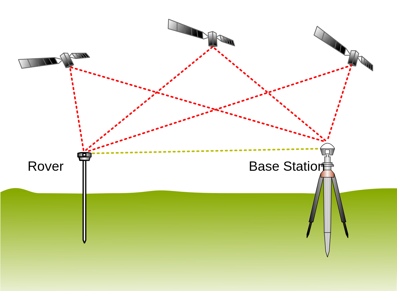
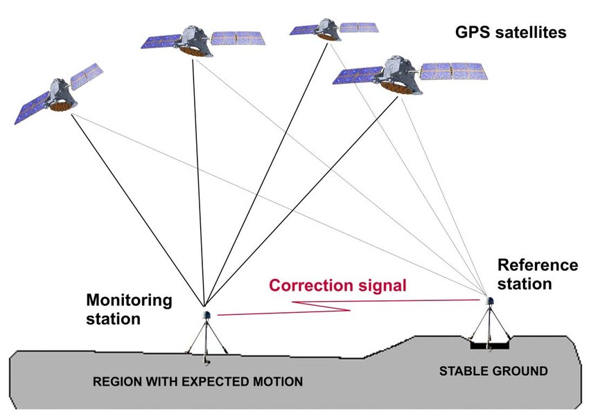
RTK GNSS (Real-Time Kinematic Global Navigation Satellite System) is a highly accurate
satellite navigation system used in various applications such as land surveying, geodesy,and autonomous vehicle navigation. Unlike traditional GPS, which offers meter-level accuracy,
RTK GNSS provides centimeter-level precision. This is achieved by using a fixed base station
and one or more mobile units (rovers) that receive corrections in real-time.
Differential GPS: A Step Towards Accuracy
Differential GPS (DGPS) is another technique to improve the accuracy
of standard GPS. It involves the use of a network of fixed ground-based
reference stations that broadcast the difference between the positions
indicated by the GPS satellites and the known fixed positions. While not
as precise as RTK GNSS, Differential GPS significantly enhances positioning
accuracy, making it suitable for applications where meter-level precision is
sufficient.
GNSS Receiver: The Heart of Precision
The GNSS Receiver is a critical component in any satellite-based navigation and positioning system.
It captures signals from multiple satellite constellations such as GPS, GLONASS, Galileo, and BeiDou.
Modern GNSS receivers are equipped with advanced algorithms and technologies to process these
signals and deliver highly accurate positioning information. They are integral to both RTK GNSS
and Differential GPS systems, ensuring the reliability and precision required for various applications.
The Role of Network RTK
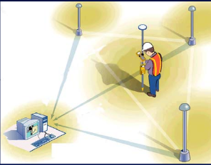
Network RTK builds upon the RTK GNSS framework by using a network of base stations
instead of a single one. This network of GNSS receivers ensures wider coverage and
better reliability. The corrections from multiple base stations are processed to create
a virtual reference station (VRS), which enhances the positional accuracy and reduces
the errors caused by atmospheric disturbances and satellite geometry. Network RTK is
particularly beneficial in large-scale projects where extensive coverage and high
precision are required.
The RTK Rover Kit: Empowering Field Operations
An RTK Rover Kit typically includes a rover unit, a controller, a pole or mount, and often a network subscription to receive corrections. These kits are designed to be robust and user-friendly, enabling surveyors and field operators to achieve precise measurements quickly and efficiently. The portability and ease of use of RTK Rover Kits make them indispensable navigation & surveying tools in industries such as construction, agriculture, and environmental monitoring.
Conclusion
The integration of advanced technologies like RTK GNSS, Network RTK, Differential GPS, and GNSS Receivers has revolutionized the field of navigation and surveying. These systems provide unparalleled accuracy and reliability, crucial for the success of various applications. For professionals relying on high-precision tools, the use of RTK Rover Kits ensures that they can perform their tasks with utmost confidence and efficiency.
As these technologies continue to evolve, the future holds even greater promise for enhanced precision and expanded applications, paving the way for innovations that will further advance the fields of geospatial science and navigation.


